Here’s How We Can Help!
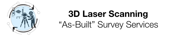
Structural Checks Using 3D Laser Scanning
We Use High-End Extremely Accurate 3D Laser Scanners
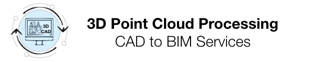
Point Cloud to Revit 3D Modeling Services
Record Project Visual Resources For The Lifecycle Of Your Project
360° Visual Walkthroughs — Look Up, Down & All Around
Manage Expectations — Share Photo Deliverables With Stakeholders
Enhance Weekly Meetings With Current Photos Of Progress & Problems
Keep Everyone ‘In-The-Loop’ From Any Location
Easily Compare Day-By-Day Progress And Check On-Sight Inventory
Your Archived Walkthroughs Provide A Historic Review
Archived Visuals Allow You To Look Inside All Closed Ceilings & Walls
Visually Compare BIM Drawings-To-Actual Build
Manage Expectations & Schedules
Define Actual “As-Built” Conditions With Precision
Compare ‘Plans-To-Actual As-Built’ Conditions — Side-by-Side
Pull Measurements Remotely With Extreme Accuracy
CLICK BELOW TO CHECK OUT OUR
SPECIALTY SERVICES
GAIN THE COMPETIVE EDGE
SAVE TIME & MONEY
3D Laser Scanning — 360° Virtual Walkthrough
Or Both
YOUR CHOICE
Here at Meyer3D, we offer our clients the best of both worlds. Our 360° Virtual Walkthroughs integrate well with and compliment our 3D Laser Scanning technologies.
We are able to save our scanning and ‘point-cloud’ clients time and money by alternating between the more expensive 3D Scans and the less expensive 360° Virtual Walkthroughs. While the two very different procedures provide very different deliverables, they complement each other to provide our clients with a Total Geospatial Business Intelligence Package to implement with their BIM strategies.
3D Laser Scanning
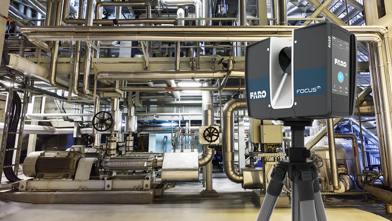
3D Laser Scans have the ability to document basically any structure to validate and record its actual “As-Built” existing condition, with extreme accuracy.
In construction, for example, when architects and engineers need to capture the real world existing condition and measurements of buildings, roads & bridges, oil & gas plants, wind turbines, and industrial facilities, they have them scanned.
Click Here to see how we process a scanned ‘Point Cloud’…
360° Virtual Walkthroughs
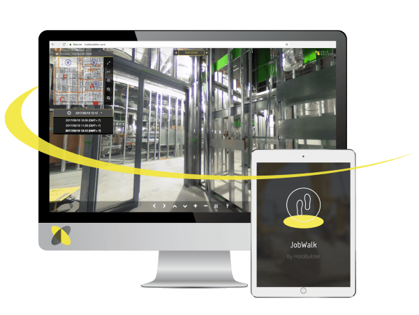
360° Virtual Walkthroughs are series of photos & videos, captured with special equipment. The user can simply click to a specific location, at a specific point in time, and scroll to look around. 360 degrees of viewing - up, down, and all around.
Over time, we strategically capture every aspect of the project. Jump back in time and see what’s inside the walls, in the ceiling, and in the floor of every room.
Click Here to see how 360° Virtual Walkthroughs Work…
The Advantage Of Using Meyer3D Services
Meyer3D Advantages
• Instant Start-up
• Low Start-Up Costs
• No Long Term Contracts
• Use Daily or Only As Needed
• No large equipment costs
• No scanner training costs
• No 360° camera training costs
• No computer / office expenses
• No CAD software fees
• Reduced SaaS software fees
• No insurance burden
All Employees
• Attend weekly project meetings
• $1,000,000 liability insurance
• Additional insurance riders available
• Carry current OSHA 30 cards
• Equipped with PPE
- Hardhats
- Safety glasses
- Level 3 anti-cut gloves
- Steel toe safety boots
- Harness & tie-off equip
Equipment
• 3D scanners
• 360° cameras
• Field support equipment
• 3D CAD work stations
• Mac & PC computers
• Encrypted RAID storage
• Off-site back-ups
CONNECTING THE REAL WORLD BUILD WITH YOUR DRAWINGS AND PLANS
HOW WE WORK
- We use high-accuracy laser scanners and HD cameras to document projects
- We massage the captured ‘Point Cloud’ data into usable 3D BIM/CAD models
- We generate exact ’As-built’ conditions and floor plans
- We certify square footage, record precise topographic elevations
- We shoot slab ‘Floor Flatness’ and ‘Floor Levelness’ numbers during the pour
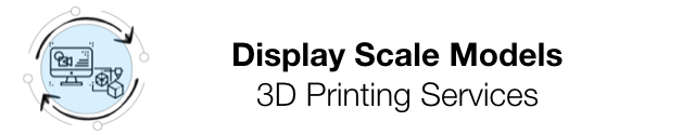
- We can even 3D print a scale model for the client and stakeholders
- We preform Daily, Weekly, or Scheduled ‘Virtual 360° Photo Walkthroughs’
- We provide cloud-storage and easy, secure, online access to all data
- We pass the information to our clients in a format and on a schedule that meets their workflow requirements and budgets
OUR CLIENTELE
- Architects, engineers, designers, builders, and contractors
- Building owners, real-estate managers, brokers and tenants
- The equipment used by Meyer3D is regularly factory calibrated and certified
- Our scans are accepted by the courts as CSI evidentiary findings
- We survey crime and accident scenes for law enforcement and attorneys
ARCHITECTURE, ENGINEERING, & CONSTRUCTION
If you are an architect or contractor, we can provide you with a daily, weekly, or scheduled series of scans and photographs that will fully capture, document, and archive the entire lifecycle of your project. This service is designed to improve your company’s decision making and collaboration abilities by providing everyone with accurate, trackable Existing Condition Surveys on a regular basis. This independent monitoring and visual documentation will help to mitigate contractor - sub disagreements and clarifies potential liability issues.
In addition, our “Clash Detection” software can spot errors and deviations between your project drawings and the reality of the build, as detected by our cloud-point scans. These discrepancies are immediately flagged. This process can spot inadvertent deviations sooner, rather than later, and helps your team avoid costly errors and omissions. Thus reducing resultant change orders, schedule delays, and potential liability issues. This helps to keep your project on schedule and on budget.
For those with tighter budgets, Meyer3D also provides ‘On Call’ validation checks of existing structures.
Our deliverables range from raw “Point-Cloud” data packs for Architects and Engineers to visually interlaced 360° HD photo walkthroughs that any authorized person can view online.
We can also provide 2D As-built plans, Revit 3D Existing Condition Survey drawings, and even 3D printed scale models based upon our laser scans.
REAL ESTATE & LEGAL
Meyer3D also meets the needs of REITs, property owners, managers, brokers, architects, and others. We offer services that can validate and certify the actual square footage of buildings using the BOMA Floor Measurement Standards. BOMA is the preferred industry standard, defining interpretation and implementation, that often benefits the building owners. In fact, laser scanning a structure, and applying the BOMA standards, often results in additional discovered square footage by 5% or more.
Meyer3D offers the ideal solution for property management, due diligence, builds outs, remodels, rebranding, acquisitions, site inspections, and expert witness litigation testimony.
Meyer3D scanning services are used by land surveyors and civil engineers, to record topographic features that are difficult to reach or record by traditional standards. (such as bridges, rugged terrain, busy roads, or aquatic boundaries). Our scanning services are also used by police, crime scene investigators, private accident re-constructionist and insurance companies to take rapid accurate measurements of scenes.
They say ‘A picture is worth a thousand words’…
If so, then a 3D Scan is worth a million!
They say ‘A picture is worth a thousand words’…
If so, then a 3D Scan is worth a million!
Meyer3D, LLC
10764 S. 93rd East Ave.
Tulsa, Oklahoma 74133
(918) 899-1932
All Rights Reserved
© Meyer3D 2023
OKLAHOMA TITLE 245 LEGAL NOTICE: Meyer3D, LLC preforms support work for firms that are licensed under title Oklahoma Title 245.
Meyer3D, LLC DOES NOT claim to be a licensed Professional Engineer or a licensed Land Surveyor company and it is NOT licensed under OK Title 245 as such.